Andorville™ Coordinates Application
Introduction
Andorville™ Coordinates is a coordinate conversion application that uses the EPSG Geodetic Parameter Dataset. This dataset can be found at:
EPSG Geodetic Parameter Dataset
The Main Form
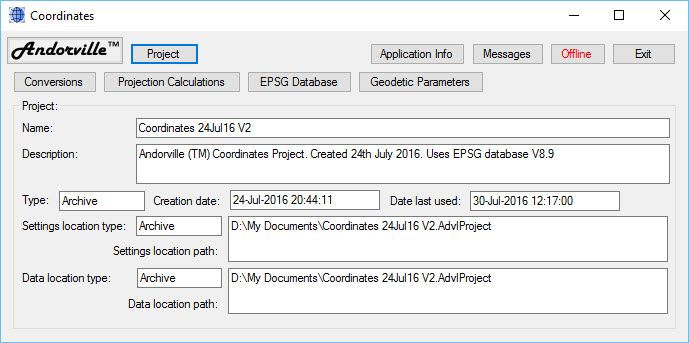
The main application form shows the parameters of the selected project including the project name and description.
All geodetic parameters and collections of coordinate points are stored in projects.
Multiple projects can be created for storing data from different areas.
Pressing the "Project" button opens the project selection form.
Pressing the "Application Info" button opens the Application Information form, which shows information about the software including the license and source code.
Pressing the "Messages" button opens the Messages window, which shows messages for the application user and XMessage instructions exchanged between applications connected to the Andorville™ Application Network.
Pressing "Offline/Online" button toggles between the Online and Offline state.
When the application is online, it is connected to the Andorville™ Application Network and the button displays green "Online" text.
When the application is offline, it is disconnected from the Application Network and the button displays red "Offline" text.
The application can only connect when the Application Network is running.
When the Coordinates application is connected to the Network, any other connected application can request point locations, coordinate conversions or geodetic parameters.
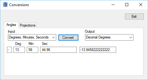
The Conversions Form
The Conversions form is used to convert angles between different units. (Other conversion options will be added later.)
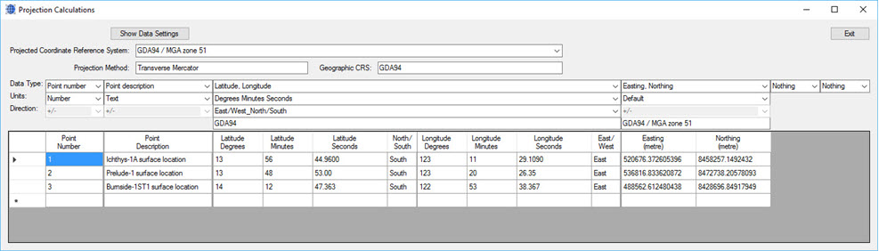
Projection Calculations
The Projection Calculations form is used to convert a set of points between geodetic and projected coordinate reference systems.
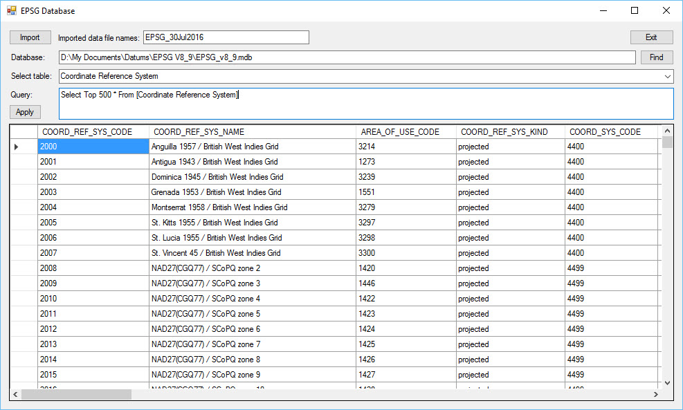
EPSG Database Form
The EPSG Database form is used to query and view tables in the EPSG Access database. The EPSG data is imported by pressing the Import button.
This saves the data in the selected project as a set of xml files with the spedcified imported data file name prefix.
The EPSG Access database V8.9 is 26.6MB in size.
Importing the data into an Andorville™ directory project occupies a similar size.
Importing the data into an Andorville™ archive project occupies only about 1.4MB.
Geodetic Parameters
Many parameters are used to define the thousands of coordinate reference systems, of several types, included in the EPSG database.
The Geodetic Parameters form is used to open separate parameter forms for each category.

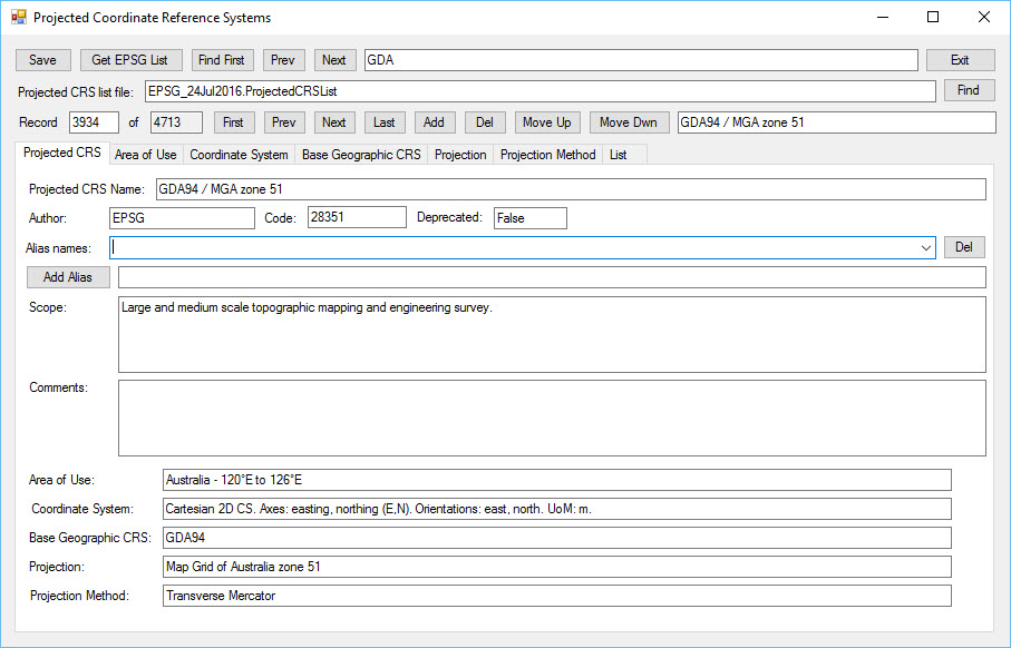
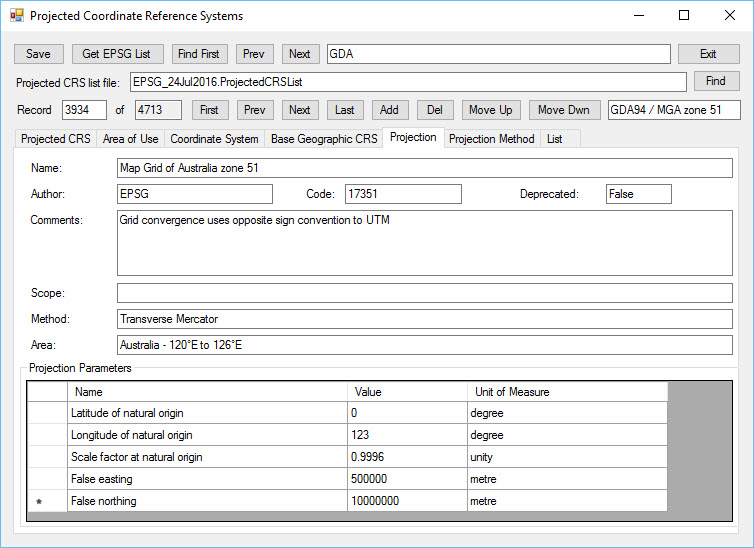
Projected Coordinate Reference Systems
This form displays the parameters used to define projected coordinate reference systems.
The Projected CRS tab (shown below) displays a summary of the selected coordinate reference system.
There are 4713 projected CRSs defined in the EPSG database version 8.9 (current as of July 2016).
Pressing the "Get EPSG List" button at the top of the form imports the data from the EPSG database into the form.
Pressing the "Save" button saves the parameters in the current project as an xml file with the name entered in the text box to the right of the "Projected CRS list file:" label.
These steps will not be required if all the data has been imported using the "EPSG Database" form.
The text box at the top of the form is used to search the names of projected CRSs.
Pressing the "Find First", "Prev" and "Next" buttons at the top of the form finds the first match, previous match and next match respectively.
The "First", "Prev", "Next" and "Last" buttons to the right of the record number labels are used to move through the set of records.
The "Add", "Del", "Move Up" and "Move Dwn" buttons are not yet implemented.
Data editing options are not implemented but the software is designed so that they can be easily added if required.
EPSG Terms of Use must be followed when using the EPSG Dataset:
EPSG Terms of Use
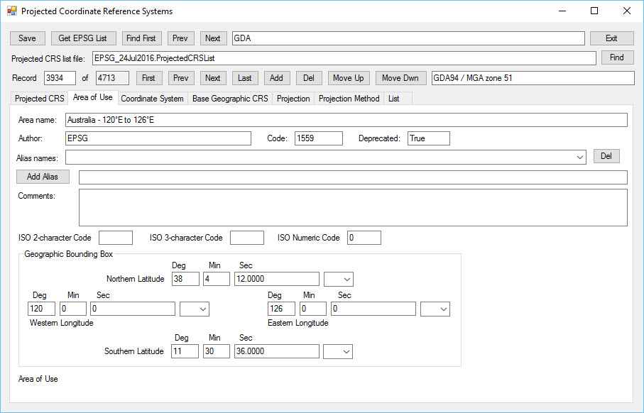
Area of Use Tab
The Area of Use tab on the Projected CRSs form shows the northern and southern latitude bounds and the western and eastern longitude bounds of the selected CRS.
Other parameters such as area name are also shown.
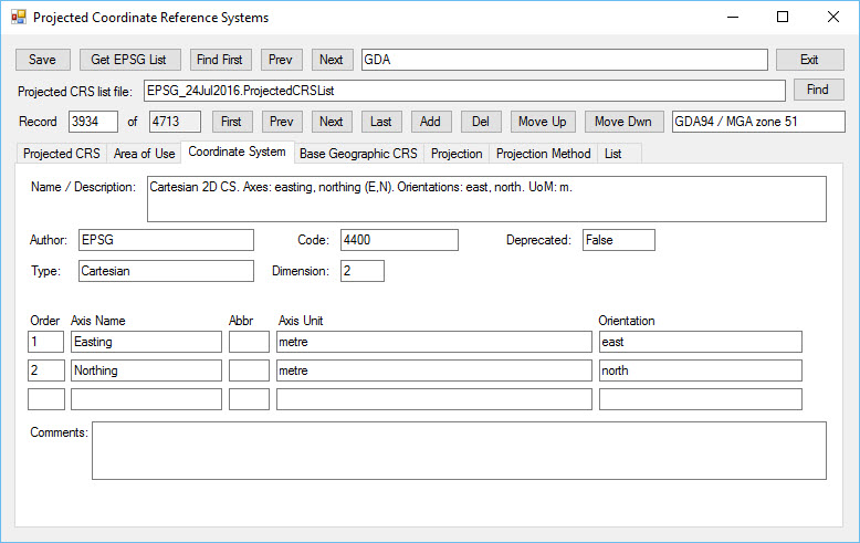
Coordinate System Tab
The Coordinate System tab shows the set of axes on which a point location is specified in the selected CRS.
Easting and Northing axes are usually used for projected coordinates.
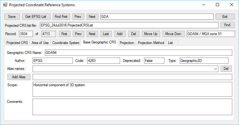
Base Geographic CRS Tab
A coordinate projection converts geographic latitude and longitude angle coordinates from a specified geographic CRS (the base CRS) to projected easting and northing coordinates.
The latitude and longitude angle coordinates are defined on an ellipsoid and the easting and northing coordinates are defined on a plane.
The Base Geographic CRS tab shows the base CRS corresponding to the selected projected CRS.
Projection Tab
The Projection tab shows a summary of the projection used in the Projected CRS including the set of projection parameters, which vary with the projection method and zone.
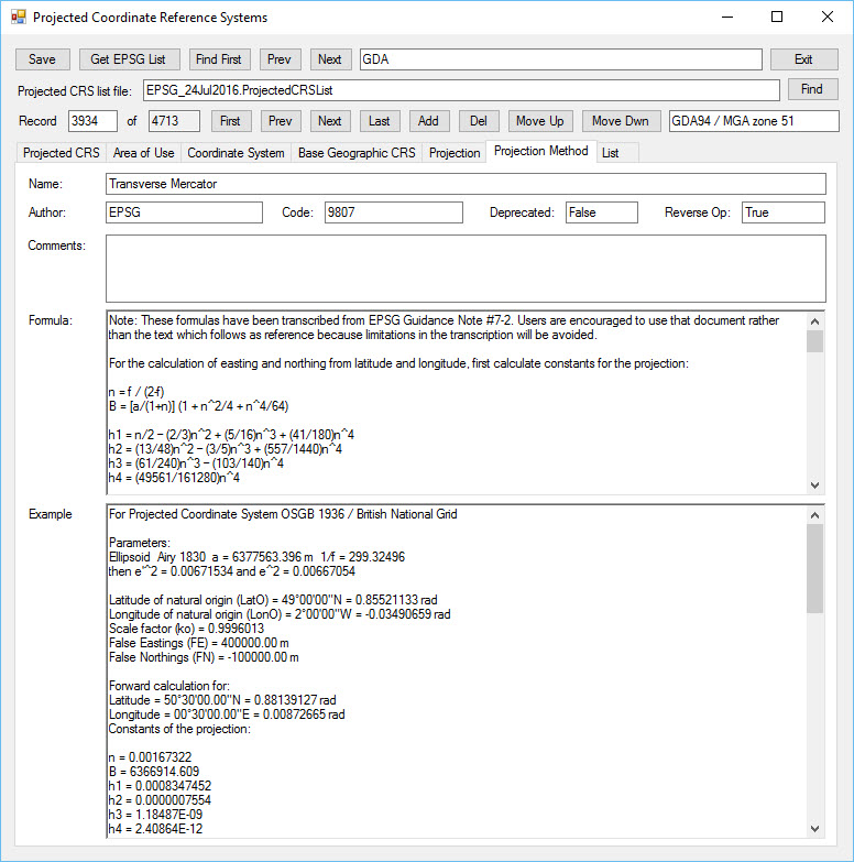
Projection Method Tab
The Projection Method tab shows the formula used to convert the geodetic latitude and longitude coordinate values to the projected easting and northing coordinate values.
A calculation example is also shown.
The TransverseMercator class in the Andorville™ Coordinates Class Library implements this formula in the Coordinates application.
This is currently the only projection method implemented.
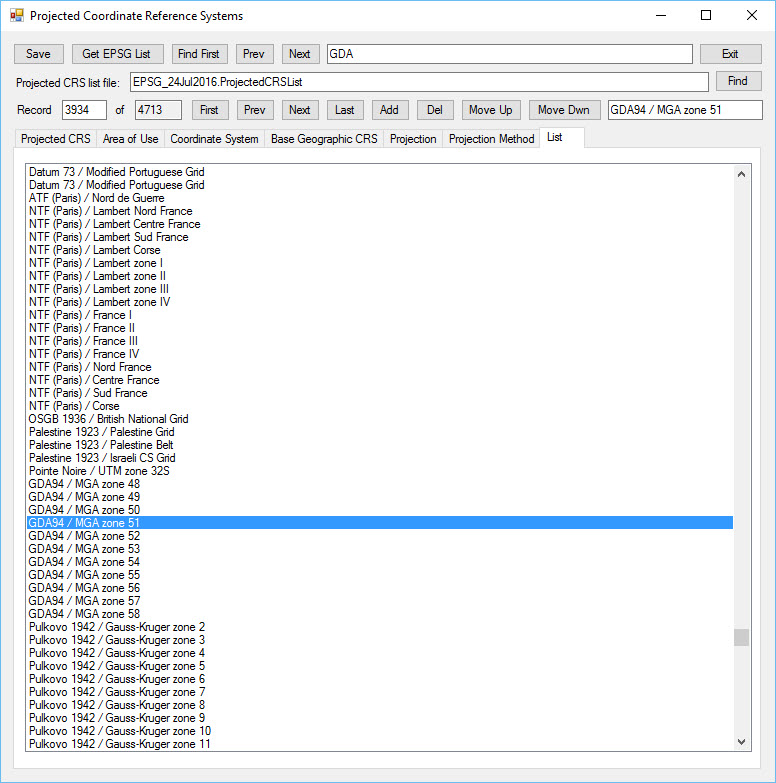
List Tab
The List tab shows a list of names of all of the projected CRSs.
Clicking on this list selects the corresponding record.
Other Geodetic Parameters
A range of other parameter forms can be opened from the Geodetic Parameters form.
The parameters forms are:
- Coordinate Reference Systems
- Summary list of all types
- Compound
- Engineering
- Geocentric
- 2D Geographic
- 3D Geographic
- Projected
- Vertical
- Datums
- Summary list of all types
- Geodetic
- Prime Meridians
- Ellipsoids
- Vertical
- Engineering
- General Parameters
- Areas of Use
- Units of Measure
- Coordinate Systems
- Coordinate Processes
- Projections
- Transformations
- Coordinate Operation Methods
Work in Progress
Currently only the transverse mercator projection is included.
Other projections may be added as required.
When processing sequences are implemented it will be possible to apply coordinate conversions to large data sets.